About Mobile Mapping
Your Specialist Partner for Mobile Mapping
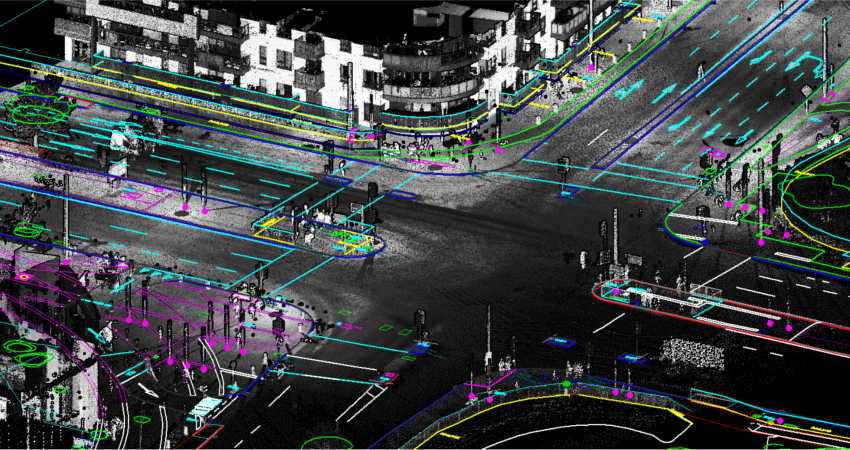
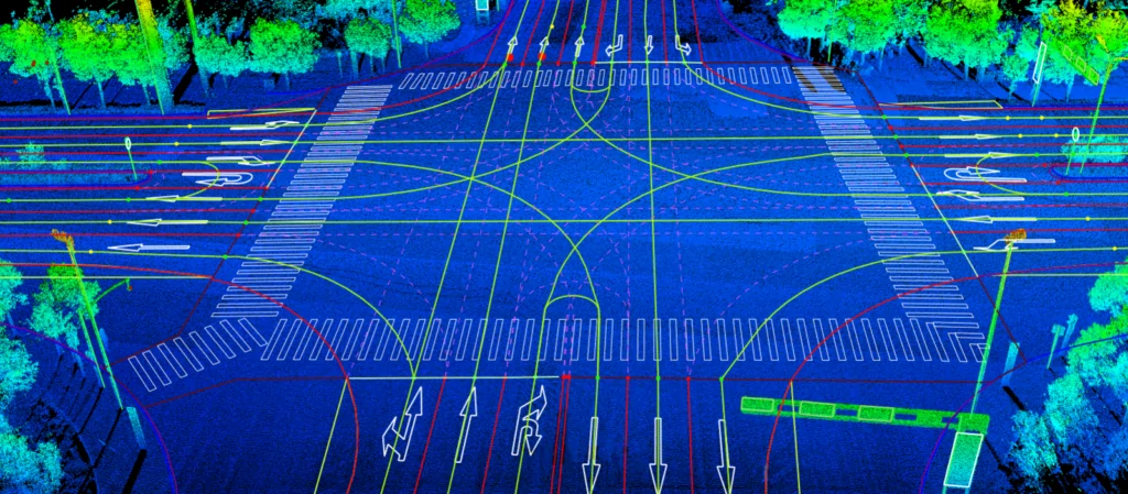
Data Processing
At Vector Mapping, we specialise in processing
raw mobile mapping datasets — captured by
vehicle-mounted LiDAR systems and camera rigs —
into accurate, geo-referenced point clouds and
structured asset databases.
Our mobile mapping processing capabilities
cover highway asset extraction, road condition
assessment, and urban corridor mapping — all
processed to your project specifications and
delivered to international geospatial standards.
We work exclusively as a back-end mobile mapping
data processing partner — handling client-supplied
datasets and transforming them into high-value
spatial deliverables.
Our AI-assisted feature extraction workflows
ensure faster turnaround and consistent accuracy
across large-volume corridor projects, giving
highway authorities and urban planners the
detailed spatial intelligence they need to make
informed decisions.